SKU (sam-016) Tavola Geografica del Romano Impero Categories , , Tags , , , ,

Romani Imperii occidentis scilicet et orientis, Tabula geographica ex Schoedis Sansoniani desumpta

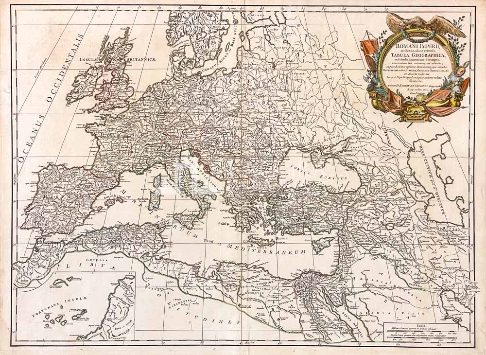
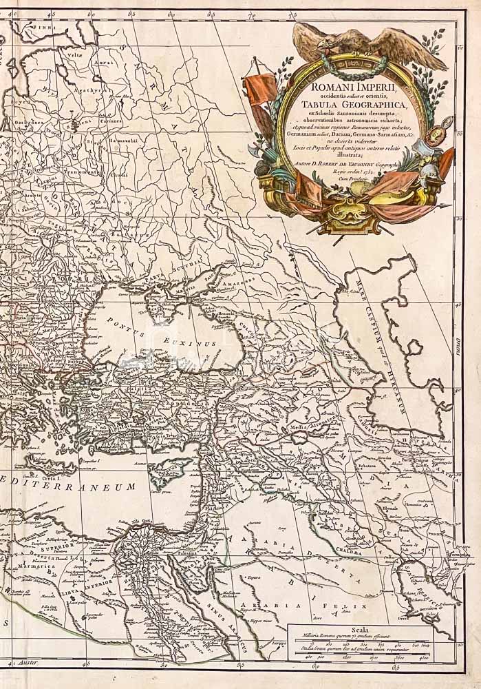
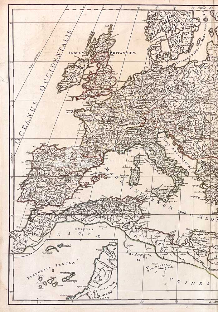
Romani Imperii occidentis scilicet et orientis, Tabula geographica ex Schoedis Sansoniani desumpta…

Rara ed affascinante mappa dell’Impero Romano di Robert de Vaugondy stampata a Parigi nel 1752 ca. Mostra l’estensione dell’Impero Romano al suo apice, compreso l’Impero Romano d’Occidente e l’Impero Romano d’Oriente: da OVEST dalle colonne di Ercole Costa Barbara (attuale Marocco) e dal Portogallo fino ad EST Mar Caspio. Da NORD Mar Baltico fino al SUD Mar Rosso. Un quadrante in basso a sinistra presenta le Isole Canarie. Questa carta geografica offre con dettagliata cura le catene montuose, i laghi, i fiumi e i siti storici.

In alto a destra un bel e decorativo cartiglio acquerellato a mano.

Autore: VAUGONDY ROBERT
Anno: 1752
Misure: cm 49,53 x 68,58 circa

Tecnica: Incisione in rame, acquerellata a mano

This item is a one of a kind. Contact us for more information

Contact us

Shipping

Shipping times take between 5 and 7 working days. If the product is out of stock, it will take between 20 and 30 days.
Free shipping for purchases of at least €300
Read more

Right of withdrawal

The private buyer who buys a good online or at a distance can return it and get a refund of the amount paid, exercising the right of withdrawal within fourteen days of delivery and/or receipt of the goods.
Read more

SKU (sam-016) Tavola Geografica del Romano Impero Categories , , Tags , , , ,

Art gallery in the heart of Taormina

THE HISTORY OF TAORMINA AND SICILY IN ART