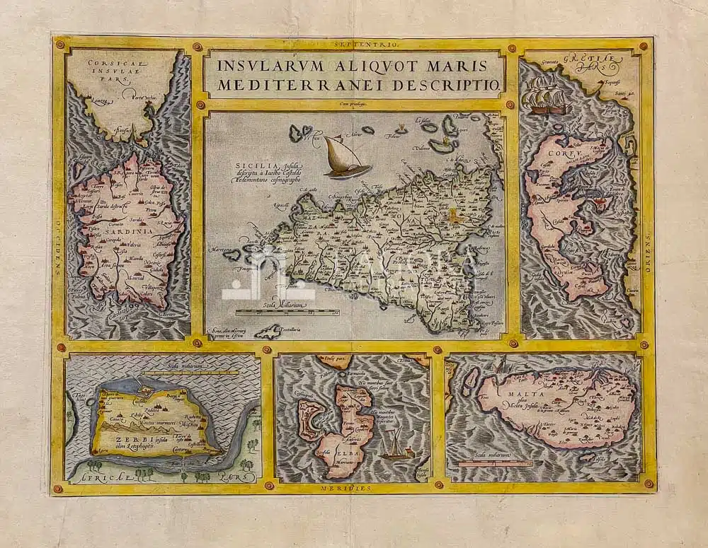
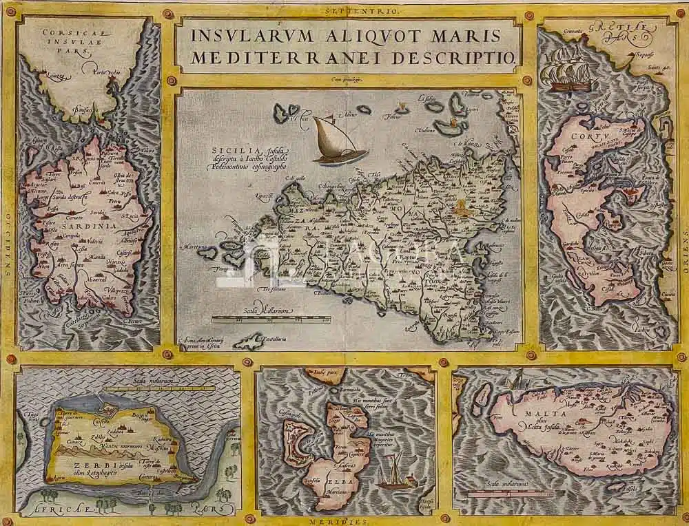
Carta geografica di Abramo Ortelio (1527-1598) raffigurante la Sicilia, la Sardegna, Malta, l’Elba, Corfù e Djerba. Ciascuna isola è inserita in una finestra a sua volta in una cornice decorata con i nomi latini dei punti cardinali su ciascun lato. La carta è tratta dal Theatrum Orbis Terrarum pubblicato nel 1570. Esso è considerato il primo vero atlante, in quanto composto da una ricca collezione di carte geografiche, tutte dello stesso formato, accompagnate ciascuna da una didascalia, raccolte e rilegate in un unico volume.
L’ Atlante di Ortelio fu tra i libri più cari del tempo. Ebbe grande richiesta e successo tanto da avere ben 42 edizioni in diverse lingue stampate fino al 1612. Nella piccola carta di Malta e’ presente anche un veliero che sta affondando in riferimento al naufragio di San Paolo avvenuto al largo dell’Isola.
Autore: Abraham Ortelius (1527-1598)
Anno: 1570
Misure: cm 36 x 47,5
Tecnica: Incisione in rame, colorata a mano