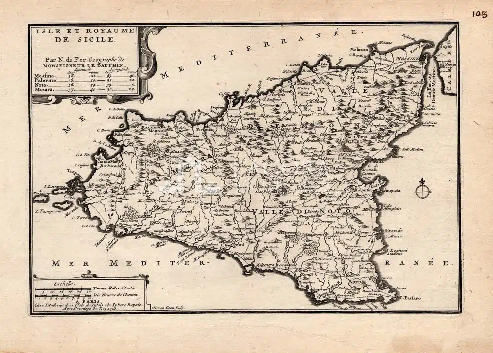
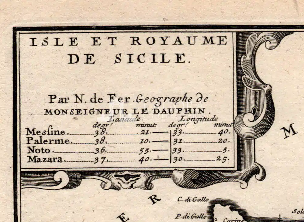
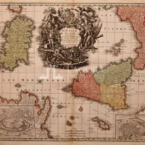
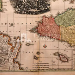
Isle et Royaume de Sicile
Una bellissima mappa della Sicilia incisa da Harmanus van Loon e creata da Nicholas De Fer per il suo Atlante “Atlas curi” del 1701.
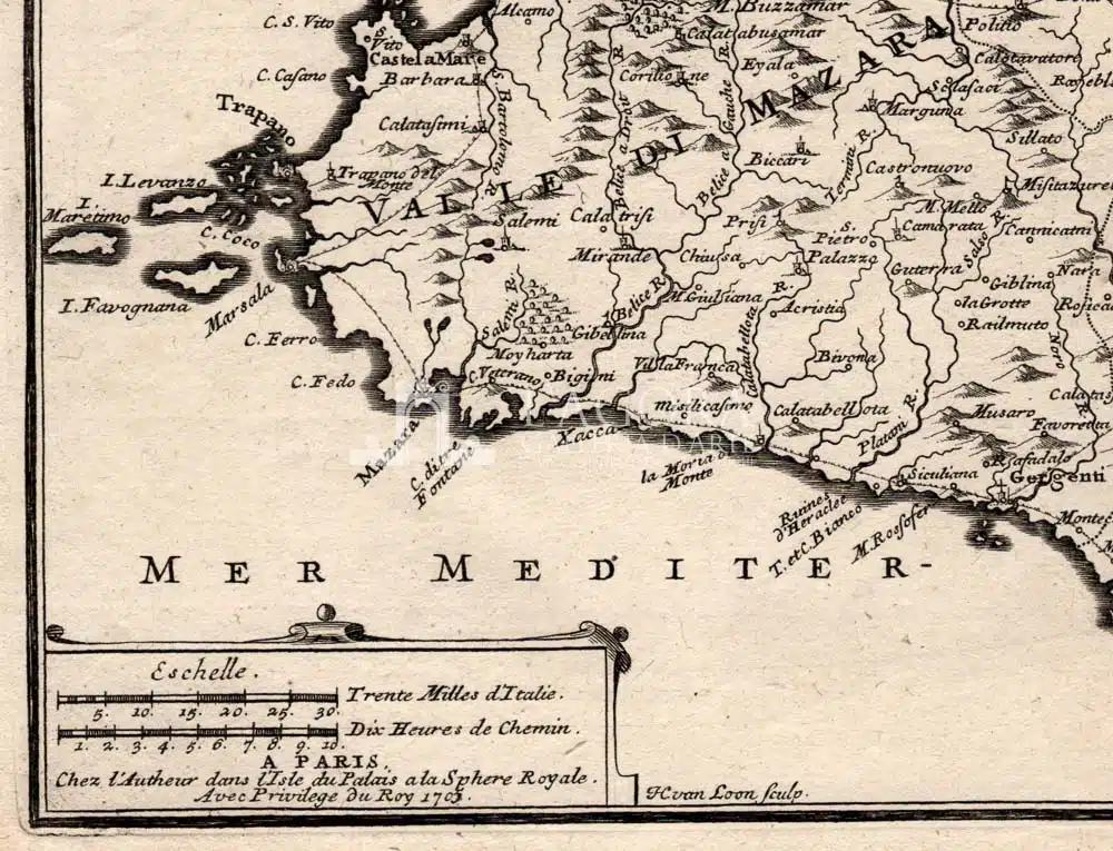
Essa si distingue per l’indicazione delle strade principali e le informazioni sia topografiche sia politiche con le montagne splendidamente rese di profilo.
Splendidamente rappresentata non poteva mancare l’ Etna fumante, con il doppio nome “Mount Aetna ou Gibello” (di origine araba).
Autore: Harmanus van Loon / Nicholas De Fer
Anno: 1705
Misure: cm L 40 x H 28 (foglio)
Tecnica: Incisione in rame