SKU (sam-055) Great Britain Homann Categories , , Tags , , ,

Magnae Britanniae pars meridionalis in qua Regnum Angliae tam in septem antiqua Anglo-Saxonum regna quom in omnes Hodiernas regiones accurate divisum hic ostenditur quam tabula ab archetypo Vischeriano desumptam exhibet

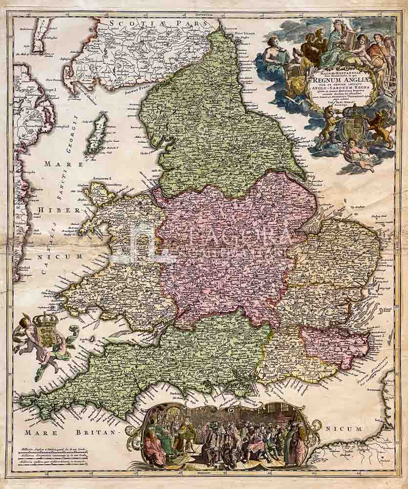
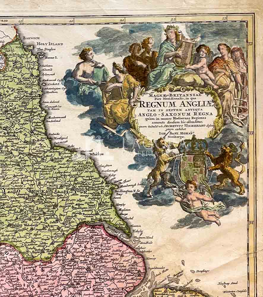
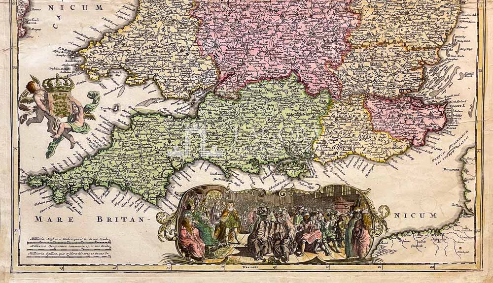
Decorativa mappa dell’Inghilterra e del Galles basata sullo studio di N. Visscher del 1695. Essa mostra i confini degli otto regni anglosassoni.

Ha un elegante cartiglio con lo stemma britannico circondato da angeli e figure allegoriche.
In basso c’è una grande vignetta della Regina Anna con la sua corte.
La carta geografica proviene dall’ Atlante Johann Baptist Homann “Atlas Novus Terrarum Orbis Imperia Regna et Status Exactis Fabulis Geographice Demonstrans” pubblicato a Norimberga intorno al 1730.

Author: Johann Baptist Homann (1663-1724)
Year: 1720
Size: 59 x 49 cm circa 
Tecnique: Copper engraving, hand colored

This item is a one of a kind. Contact us for more information

Contact us

Shipping

Shipping times take between 5 and 7 working days. If the product is out of stock, it will take between 20 and 30 days.
Free shipping for purchases of at least €300
Read more

Right of withdrawal

The private buyer who buys a good online or at a distance can return it and get a refund of the amount paid, exercising the right of withdrawal within fourteen days of delivery and/or receipt of the goods.
Read more

SKU (sam-055) Great Britain Homann Categories , , Tags , , ,

Art gallery in the heart of Taormina

THE HISTORY OF TAORMINA AND SICILY IN ART