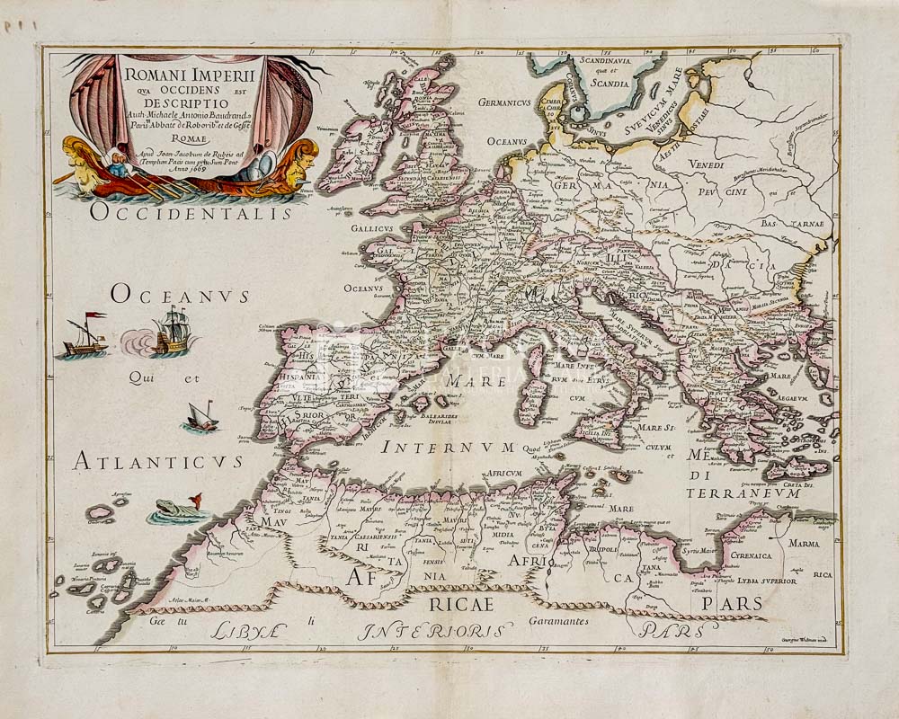
Elegant and rare map of the Western Roman Empire, engraved in etching on copper by Georgius Widman after a design by the French geographer Michel-Antoine Baudrand. Published in Rome in 1669 by Giovanni Giacomo de Rossi, it features beautifully hand-watercoloured borders and a majestic Baroque cartouche.
This extraordinary 17th-century map offers a refined historical and territorial reconstruction of the Western Roman Empire. Compiled by the renowned French geographer Michel-Antoine Baudrand, the work depicts the classical geography of Europe and North Africa with meticulous detail, extending from the coasts of Britannia and Iberia to the course of the Danube and the territories of Cyrenaica.
The toponymy is entirely rendered in Latin, identifying the names of the ancient Roman provinces—Hispania, Gallia, Britannia, Germania Inferior, Italia, Mauretania, and Africa Proconsularis—as well as regional tribal divisions and the classical seas, including Mare Internum, Oceanus Atlanticus, and Mare Suevicum.
Author: Giovanni Giacomo De Rossi (1627 – 1691) / Michel Antoine Baudrand (1633 – 1700)
Year: 1669
Size: 53 x 41 cm circa (plate mark)
Technique: Copperplate etching, hand-coloured